

Digital Surface Model (DSM)
April 26, 2024
The Importance of Drainage Analysis in Australia
May 13, 2024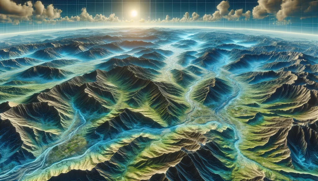
In today’s digital age, there are numerous technologies and tools that have revolutionized the way we analyze and interpret geographical data. One such tool is the Digital Elevation Model (DEM). Understanding DEMs is crucial for anyone involved in the fields of geography, cartography, remote sensing, or any other discipline that deals with elevation data. In this article, we will delve into the definition, importance, components, types, processing, analysis, challenges, and limitations of DEMs. So, let’s begin our journey into the intriguing world of Digital Elevation Models.
Understanding Digital Elevation Models (DEM)
Before we dive into the intricacies, let’s start by defining what exactly a Digital Elevation Model is. Put simply, a DEM is a digital representation of the Earth’s surface, capturing the elevation values of different points across a given area. These elevation values are typically measured in relation to a reference datum, such as sea level. DEMs are commonly represented in a grid format, where each grid cell corresponds to a specific location on the Earth’s surface.
Definition and Basic Concepts of DEM
A Digital Elevation Model is essentially a collection of elevation data points, stitched together to form a continuous surface representation. These data points are obtained through various techniques, including remote sensing technologies like LiDAR (Light Detection and Ranging) or satellite imagery. DEMs allow us to visualize and analyze the topography of an area, helping us understand the spatial distribution of features like mountains, valleys, rivers, and more.
One fundamental concept to grasp about DEMs is the notion of spatial resolution. Spatial resolution refers to the level of detail captured in the DEM. Higher resolution DEMs contain more data points per unit area, resulting in a more detailed representation of the Earth’s surface. Conversely, lower resolution DEMs have larger grid cells, yielding a less detailed depiction of the terrain.
Importance and Applications of DEM
DEM data plays a vital role in various applications across different industries. For instance, in the field of civil engineering, DEMs are instrumental in designing infrastructure projects like roads, bridges, and dams. By analyzing elevation data, engineers can assess the slope, drainage patterns, and other terrain characteristics that impact the construction process.
Furthermore, DEMs are valuable in environmental studies and land management. They aid in predicting and modeling water flow, soil erosion, and landform changes. Researchers also use DEMs to study the effects of climate change on landscapes, helping us gain insights into the Earth’s dynamic processes.
The use of DEMs extends beyond Earth sciences – it is also integral to activities like flight planning and navigation. Pilots and air traffic controllers rely on accurate elevation data to ensure safe takeoffs, landings, and routes. Similarly, in the realm of satellite imagery, DEMs help correct geometric distortions caused by the Earth’s curvature, enabling more accurate mapping and analysis.
Moreover, DEMs have found applications in the field of archaeology. By analyzing elevation data, archaeologists can identify potential archaeological sites and study ancient landscapes. This allows them to gain a deeper understanding of past civilizations and their relationship with the environment.
Another interesting application of DEMs is in the realm of renewable energy. DEM data is used to identify suitable locations for wind farms and solar installations. By analyzing elevation and slope data, energy companies can determine the optimal placement of renewable energy infrastructure, maximizing energy generation and minimizing environmental impact.
Furthermore, DEMs have proven to be crucial in disaster management and risk assessment. By analyzing elevation data, scientists can model and predict the impact of natural disasters such as floods, landslides, and tsunamis. This information is invaluable in developing early warning systems and implementing effective mitigation strategies to protect vulnerable communities.
As technology continues to advance, the accuracy and resolution of DEMs are constantly improving. This allows for more precise analysis and decision-making in various fields, contributing to a better understanding of our planet and its complex dynamics.
Components of Digital Elevation Models
Now that we have a grasp of the fundamental concepts, let’s explore the different components that make up a Digital Elevation Model.
Data Collection in DEM
The process of collecting elevation data for creating a DEM can be carried out using a variety of methods. One common technique is LiDAR, which involves emitting laser beams from an aircraft or a ground-based instrument and measuring the time it takes for those beams to return after hitting the Earth’s surface. These measurements are then used to calculate the distance between the sensor and the surface, resulting in highly accurate elevation data.
Satellite imagery is another widely used source for collecting elevation data. Satellites equipped with remote sensing instruments capture high-resolution images of the Earth’s surface and use stereo imagery techniques to extract elevation information from those images. This data is then used to generate DEMs with varying levels of resolution and accuracy.
LiDAR and satellite imagery are not the only methods for collecting elevation data. Other techniques include photogrammetry, which uses overlapping aerial photographs to create 3D models of the Earth’s surface, and ground-based surveys, where surveyors use specialized equipment to measure elevation at specific locations. Each method has its own advantages and limitations, and the choice of technique depends on factors such as the area of interest, budget, and desired level of accuracy.
DEM Resolution and Accuracy
The resolution and accuracy of a DEM are crucial factors that determine the quality and usability of the data. Resolution refers to the size of each grid cell in the DEM. Higher resolution DEMs, with smaller grid cells, provide finer details, while lower resolution DEMs sacrifice detail for broader coverage.
Accuracy, on the other hand, refers to how closely the DEM represents the true elevation values of the Earth’s surface. Achieving high accuracy requires meticulous data collection, ground control points, and meticulous processing and validation techniques. Accuracy is especially important in applications like flood modeling, where even a small error in elevation can have significant consequences.
Improving the resolution and accuracy of DEMs is an ongoing challenge in the field of geospatial data. Researchers and scientists are constantly developing new algorithms and techniques to enhance the quality of elevation data. This includes methods for improving the spatial resolution of satellite imagery, refining LiDAR data processing algorithms, and integrating data from multiple sources to create more comprehensive and accurate DEMs.
Types of Digital Elevation Models
While Digital Elevation Models share a common goal of representing the Earth’s surface, they can be classified into different types based on their data structure and representation.
Raster DEM
Raster DEMs are the most commonly used type of DEMs. They are represented in a grid format, where each cell contains an elevation value. Raster DEMs are easy to work with and are compatible with a wide range of GIS (Geographic Information System) software, making them popular for various applications.
Vector DEM
Vector DEMs, on the other hand, represent elevation data using vector geometry, such as points, lines, and polygons. These geometric elements are connected to form TINs (Triangular Irregular Networks) that approximate the Earth’s surface. Vector DEMs are useful in certain applications, such as 3D modeling and visualization, where a more detailed representation of terrain features is required.
Processing and Analysis of DEM Data
Now that we have a good understanding of the components and types of Digital Elevation Models, let’s explore how we can process and analyze the data to extract valuable insights.
DEM Data Processing Techniques
Processing DEM data involves a variety of techniques to manipulate and enhance the data for specific purposes. Common processing techniques include filtering, smoothing, resampling, and mosaicking. Filtering is used to remove noise or artifacts from the DEM, while smoothing helps to reduce variations in elevation values. Resampling involves changing the resolution of the DEM, and mosaicking is the process of merging multiple DEMs to create a seamless representation of a larger area.
DEM Data Analysis and Interpretation
Once the DEM data has been processed, it can be subjected to various analytical techniques to extract meaningful information. Slope analysis, aspect analysis, and watershed delineation are some common examples of DEM analysis. Slope analysis helps identify areas of steep terrain, while aspect analysis determines the direction that a slope faces. Watershed delineation identifies drainage basins and stream networks, assisting in water resource management and flood forecasting.
Challenges and Limitations of DEM
Despite their remarkable capabilities, Digital Elevation Models are not without their challenges and limitations. Let’s explore some of the common ones.
Common Errors in DEM
Errors can occur during various stages of DEM creation, including data acquisition, processing, and interpretation. One common error is the presence of outliers or spurious data points in the elevation data, which can significantly impact the accuracy and usability of the DEM. Other errors include data artifacts caused by vegetation cover, shadows, or sensor limitations.
Overcoming DEM Limitations
While DEMs have their limitations, there are methods to mitigate these challenges and improve the quality of the data. High-resolution data acquisition, careful processing techniques, using ground control points for accuracy assessment, and employing advanced algorithms for error detection and correction are some strategies to overcome the limitations of DEMs.
In conclusion, Digital Elevation Models are powerful tools that offer valuable insights into the Earth’s topography and play a crucial role in various applications. Understanding the concepts, components, types, and processing techniques of DEMs is vital for anyone involved in the analysis and interpretation of elevation data. By harnessing the power of DEMs and addressing their challenges, we can continue to explore and unlock the mysteries of the Earth’s dynamic landscapes.